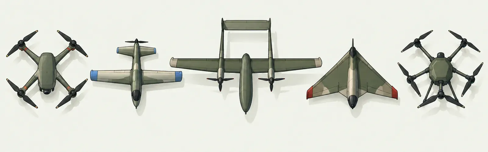
Five drone types in a row seen from above: two quadcopters, a small fixed wing drone, a larger twin boom drone and a delta wing drone.
Drone wiki · Software

Drone software directory

The programs that plan drone flights, turn drone photos into maps, keep flight records, show where flying is allowed and train new pilots, plus the software published sources say Ukrainian forces used in battle. Each entry says what the program does, who uses it and where to get it from the maker.

Mission planning and ground control

A ground control program draws the route a drone will fly, sends it to the aircraft and shows where the aircraft is. It is the screen an operator works from before and during a flight.

Mission planning and ground controlThree connected ideas: Information, Software role, Record & review. A conceptual teaching illustration without engineering or operating specifications.CONCEPTUAL ROLE OVERVIEWInformationSoftware roleRecord & reviewRoles and evidence, without engineering specifications
Conceptual illustration of a teaching role; not an engineering plan or an operating guide.

QGroundControl

Dronecode Foundation

Plans missions, sets up the aircraft and shows its position and status in flight, for drones running the open PX4 or ArduPilot autopilots.

For
Hobbyists, universities and researchers
Price
Free, open source
Runs on
Windows, macOS, Linux, Android, iOS
Official site

Mission Planner

ArduPilot project

Plans routes, sets up ArduPilot aircraft and reads flight logs after landing.

For
Hobbyists, universities and developers
Price
Free, open source
Runs on
Windows
Official site

UgCS

SPH Engineering

Plans survey, inspection and LiDAR flights over real terrain, including several drones at once.

For
Survey and inspection companies
Price
Paid subscription or one time licence
Runs on
Windows, macOS, Linux; Android app for DJI drones
Official site

DJI Pilot 2

DJI

The flight app on DJI enterprise remote controllers: route planning, camera control and mapping missions.

For
Commercial, inspection and public safety pilots
Price
Free with DJI enterprise drones
Runs on
DJI enterprise remote controllers
Official site

Mapping and surveying

Mapping programs turn hundreds of overlapping drone photos into one measured map or 3D model. Surveyors, farmers, builders and disaster teams use the results; militaries use the same method for terrain study.

Mapping and surveyingThree connected ideas: Information, Software role, Record & review. A conceptual teaching illustration without engineering or operating specifications.CONCEPTUAL ROLE OVERVIEWInformationSoftware roleRecord & reviewRoles and evidence, without engineering specifications
Conceptual illustration of a teaching role; not an engineering plan or an operating guide.

PIX4Dmatic

Pix4D

Builds measured maps, elevation models and point clouds from drone photos. Version 2.0 (January 2026) absorbed the older PIX4Dsurvey.

For
Surveyors and engineers
Price
Paid subscription
Runs on
Desktop
Official site

DroneDeploy

DroneDeploy

Plans mapping flights and processes the photos in the cloud into maps and 3D models that a whole team can open.

For
Construction, energy and farming companies
Price
Paid subscription, free trial
Runs on
Web, iOS, Android
Official site

Agisoft Metashape

Agisoft

Builds 3D models and maps from photos taken by any camera, including drone cameras.

For
Surveyors, archaeologists, researchers and students
Price
One time licence, education pricing
Runs on
Windows, macOS, Linux
Official site

WebODM

WebODM project

Processes drone photos into maps and 3D models on your own computer, with nothing uploaded. It separated from OpenDroneMap in April 2026; both continue.

For
Students, aid groups and small firms
Price
Free, open source
Runs on
Windows, macOS, Linux
Official site

OpenDroneMap

OpenDroneMap project

The open processing toolkit that turns aerial photos into maps, elevation models and point clouds.

For
Developers, researchers and aid groups
Price
Free, open source
Runs on
Windows, macOS, Linux
Official site

DJI Terra

DJI

Builds maps and 3D models from DJI drone photos and LiDAR scans.

For
Surveyors and farmers using DJI aircraft
Price
Permanent licence, education version
Runs on
Windows
Official site

ArcGIS Drone2Map

Esri

Turns drone photos into maps that load straight into the ArcGIS mapping system. Esri’s flight app is now ArcGIS Flight; Site Scan Flight was retired in July 2025.

For
Government and GIS teams
Price
Paid licence
Runs on
Windows
Official site

Flight logs, fleets and compliance

Logbook programs store every flight, track battery health and keep the records aviation regulators ask for. Organisations with many pilots use them to see who flew what, where and when.

Flight logs, fleets and complianceThree connected ideas: Information, Software role, Record & review. A conceptual teaching illustration without engineering or operating specifications.CONCEPTUAL ROLE OVERVIEWInformationSoftware roleRecord & reviewRoles and evidence, without engineering specifications
Conceptual illustration of a teaching role; not an engineering plan or an operating guide.

Airdata UAV

Airdata

Uploads flight logs automatically, replays each flight and warns when a battery or motor starts to wear.

For
Individual pilots and fleets
Price
Free tier, paid subscription
Runs on
Web
Official site

Aloft

Aloft, now part of Versaterm

Fleet records, airspace checks and instant permission to fly in controlled US airspace (LAANC). Versaterm bought Aloft in February 2026, so the name may change.

For
US pilots, police and fire departments, companies
Price
Free for individual pilots, paid for organisations
Runs on
Web, iOS, Android
Official site

DroneLogbook

DroneLogbook

Logs flights, pilots, aircraft and maintenance, and produces the records regulators ask for.

For
Commercial operators
Price
Free tier, paid per user
Runs on
Web, mobile
Official site

Airspace and flight authorisation

Airspace apps show where a drone may fly legally: airports, restricted areas and temporary closures. In some countries they also request permission to fly in controlled airspace.

Airspace and flight authorisationThree connected ideas: Information, Software role, Record & review. A conceptual teaching illustration without engineering or operating specifications.CONCEPTUAL ROLE OVERVIEWInformationSoftware roleRecord & reviewRoles and evidence, without engineering specifications
Conceptual illustration of a teaching role; not an engineering plan or an operating guide.

B4UFLY

US Federal Aviation Administration programme

Tells recreational pilots in the United States whether they may fly at a given spot. Several FAA approved companies publish B4UFLY apps; the FAA page lists them.

For
Recreational pilots in the United States
Price
Free
Runs on
iOS, Android, web
Official site

DJI FlySafe (GEO zones)

DJI

The airspace map built into DJI apps. Since 13 January 2025, in the United States it uses FAA data and shows former no fly zones as warnings rather than blocking the aircraft.

For
Anyone flying a DJI drone
Price
Free, built into DJI apps
Runs on
DJI apps
Official site

OpenSky

Wing

Shows where you may fly and, in Australia, is a drone safety app verified by the aviation regulator CASA.

For
Pilots in Australia and the United States
Price
Free
Runs on
iOS, Android
Official site

Training simulators

Simulators let a pilot practise on a computer before flying a real aircraft. Some teach the regulated skills tested for a commercial licence; others train fast manual flying with first person view goggles.

Training simulatorsThree connected ideas: Information, Software role, Record & review. A conceptual teaching illustration without engineering or operating specifications.CONCEPTUAL ROLE OVERVIEWInformationSoftware roleRecord & reviewRoles and evidence, without engineering specifications
Conceptual illustration of a teaching role; not an engineering plan or an operating guide.

Zephyr

Little Arms Studios

Teaches drone flying and the regulated skills of commercial operation, with lessons an instructor can assign and track.

For
Schools, training academies and new pilots
Price
Paid plans for individuals and organisations
Runs on
Desktop
Official site

RealFlight

Horizon Hobby

A long running radio control flight simulator with planes, helicopters and multirotors.

For
Beginners and hobby pilots
Price
One time purchase
Runs on
Windows
Official site

Liftoff: FPV Drone Racing

LuGus Studios

First person view flight practice with real drone physics, used by racing pilots to learn manual control.

For
FPV pilots
Price
One time purchase
Runs on
Windows, macOS, Linux
Official site

VelociDrone

VelociDrone

First person view flight simulator with online races and a large track library.

For
FPV pilots
Price
One time licence
Runs on
Windows, macOS, Linux
Official site

Software reported in war

Since 2022 Ukrainian forces have used software to share what drones see with artillery and other units in minutes. The entries below say only what published sources say, and name those sources.

Software reported in warThree connected ideas: Information, Software role, Record & review. A conceptual teaching illustration without engineering or operating specifications.CONCEPTUAL ROLE OVERVIEWInformationSoftware roleRecord & reviewRoles and evidence, without engineering specifications
Conceptual illustration of a teaching role; not an engineering plan or an operating guide.

Delta

Ukrainian Ministry of Defence

A situational awareness system that puts reports from drones, units and sensors on one shared map. Ukraine extended it to all defence forces in August 2024.

For
Ukrainian armed forces
Price
Not sold
Runs on
Military only

Reported in use against the Russian convoy north of Kyiv in 2022 (The New York Times, cited by Wikipedia), and in the sinking of the Moskva and the retaking of Snake Island (ACIG Journal).

Battles Russian Kyiv convoy, Battle of Kyiv (2022), Sinking of the Moskva, Snake Island campaign

Wikipedia

GIS Arta

Ukrainian volunteer developers

Matches a target reported by a drone or observer with the artillery unit best placed to fire on it, cutting the time between seeing and striking.

For
Ukrainian artillery units
Price
Not sold
Runs on
Military only

The Times reported that it helped destroy a Russian battalion crossing the Siverskyi Donets river in May 2022.

Battles Battle of the Siverskyi Donets

Wikipedia

TAK (ATAK)

TAK Product Center, first built by the US Air Force Research Laboratory

A shared map app for phones and tablets that shows team positions and reports. The civilian version, ATAK-CIV, is a free public download used by firefighters and search and rescue teams.

For
Military, emergency services, search and rescue
Price
ATAK-CIV free
Runs on
Android, Windows, iOS

We found no reputable source tying TAK to a named battle in the wars covered here.

tak.gov

Checked against each maker’s own site on 3 October 2026. Prices and features change; the official site is always the final word. Drone Front is not paid by any company listed. Flight controller firmware and tools for building or modifying drones are not listed, because this simulation covers command decisions, not building aircraft.

See also the drone wiki and the battle index.